

Russ Grayson
ZigZag to the summit
Up the ZigZag - a walk on Mt Wellington
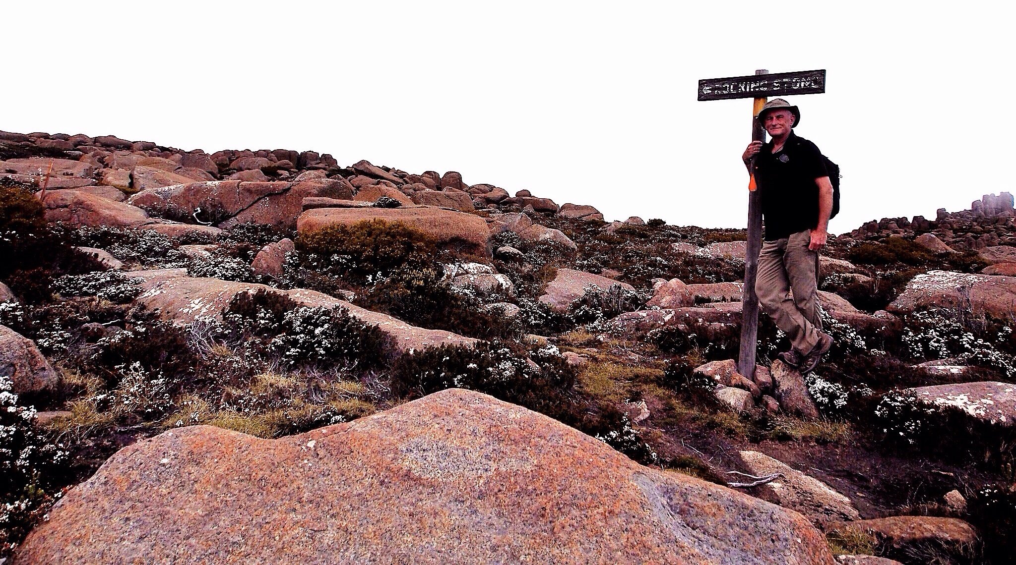
We made the short excursion out to Rocking Stone.
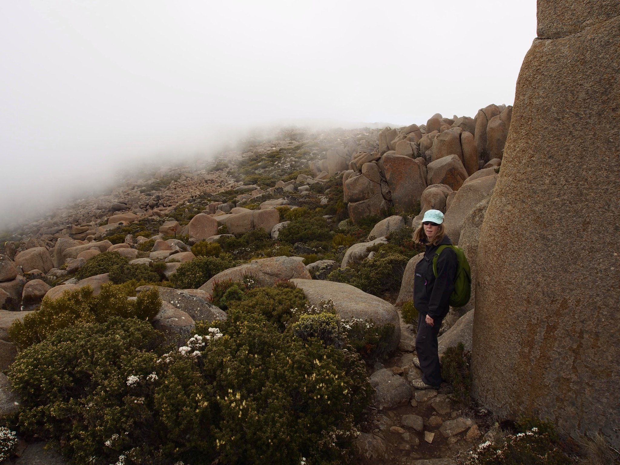
Here, dark clouds moved in and the light level fell. I had been on other Tasmanian mountains when this had happened and the temperature had dropped rapidly and snow start to fall. Today, however, it was just fog that came in to obscure the route ahead and dull the colour of the rock and vegetation, resulting in an underexposed image.
You can see summer's white flowers on the hardy alpine shrubs. Tough, wiry plants, they are frequently covered with snow in winter and are low-growing because of the strong winds that come in from the southwest.
Rocking stone is a perched dolerite boulder. Walkers sometimes climb onto the rock to move it back and forth, though I was told it no longer rocks. I didn't climb up to see if that was true.
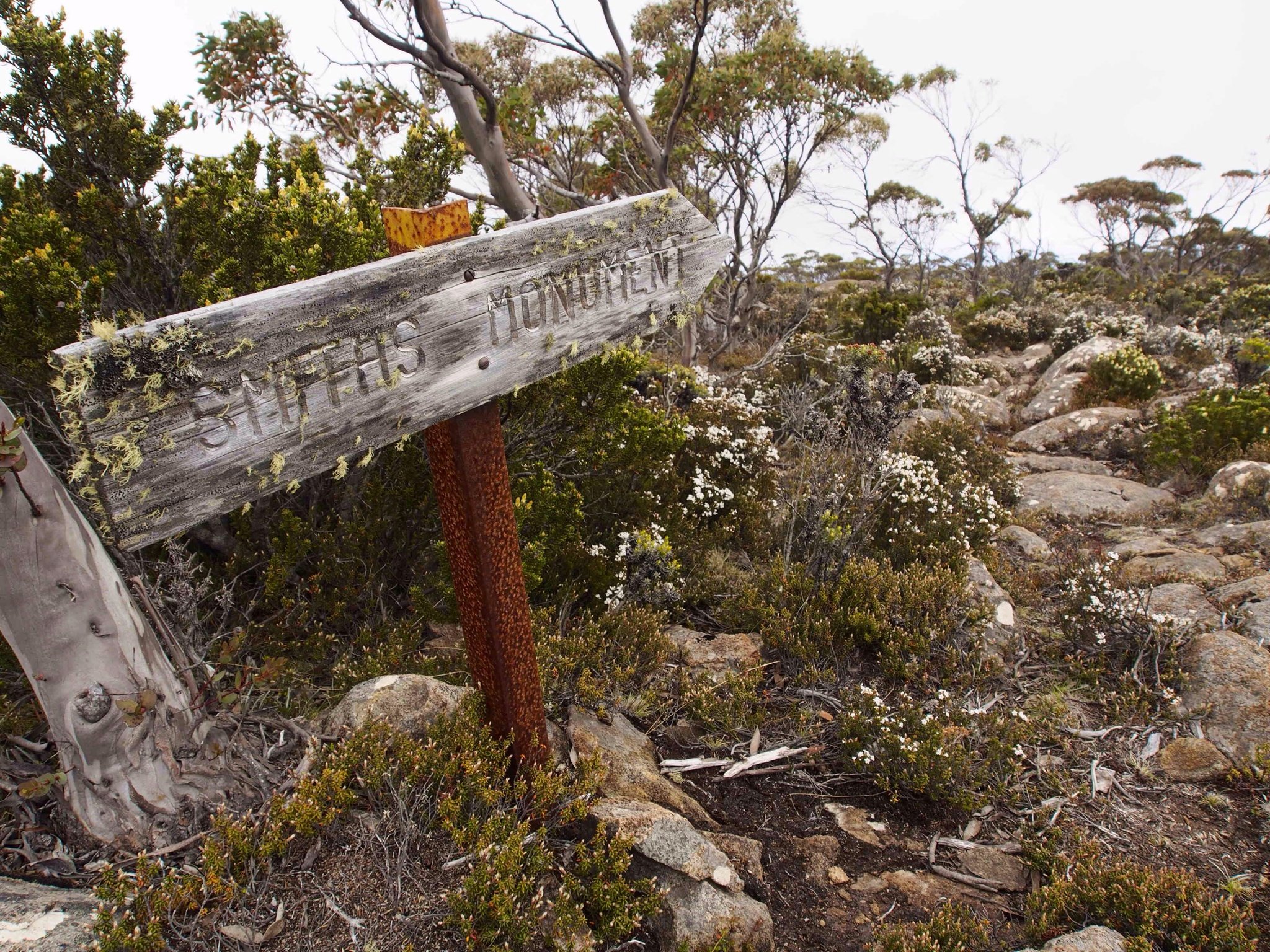
Some distance past the Rocking Stone track intersection, the trail descends into a patch of stunted snow gum. Here, we encounter the sign pointing to Smith's Monument, further out on the summit plateau.
Smith was a Nineteenth Century ship's surgeon, a crew member of the Derwentwater. He was lost out there on the Mt Wellington plateau and is remembered today by a small memorial. The story is that one of the search parties looking for Smith was twice attacked by bandits.
Smith was a Nineteenth Century ship's surgeon, a crew member of the Derwentwater. He was lost out there on the Mt Wellington plateau and is remembered today by a small memorial. The story is that one of the search parties looking for Smith was twice attacked by bandits.
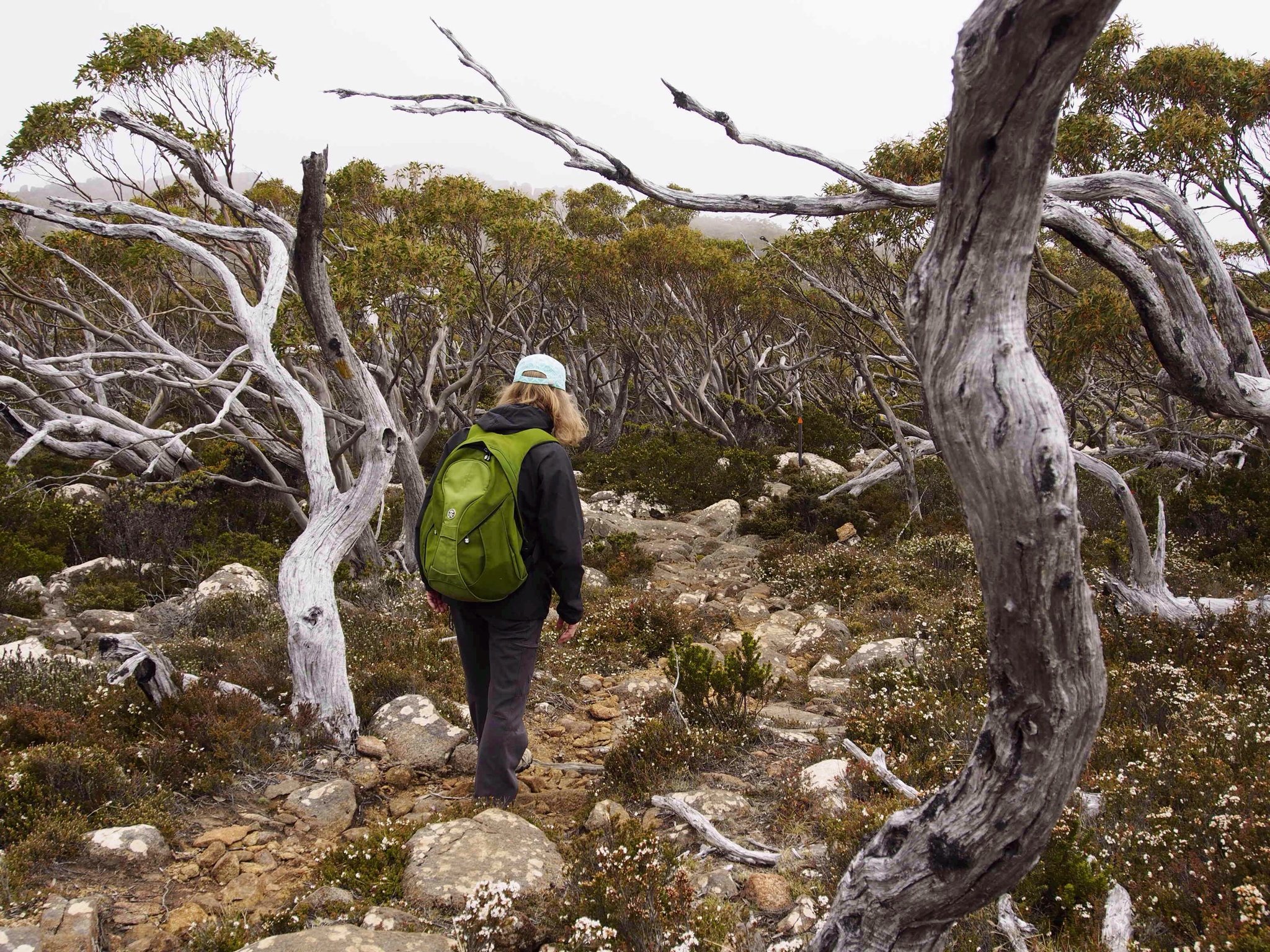
Past Smiths Monument, the track moves into a high altitude snow gum forest.
The Tasmanian snow gum, Eucalyptus coccifera, also known as the Mt Wellington Peppermint, forms the upper reaches of forest on the higher Tasmanian mountains, an interface between the taller, lower forest and the alpine shrubland. It is a low-growing species accustomed to wind, rain, cold and snow and forms a low, open forest structure.
The Tasmanian snow gum, Eucalyptus coccifera, also known as the Mt Wellington Peppermint, forms the upper reaches of forest on the higher Tasmanian mountains, an interface between the taller, lower forest and the alpine shrubland. It is a low-growing species accustomed to wind, rain, cold and snow and forms a low, open forest structure.
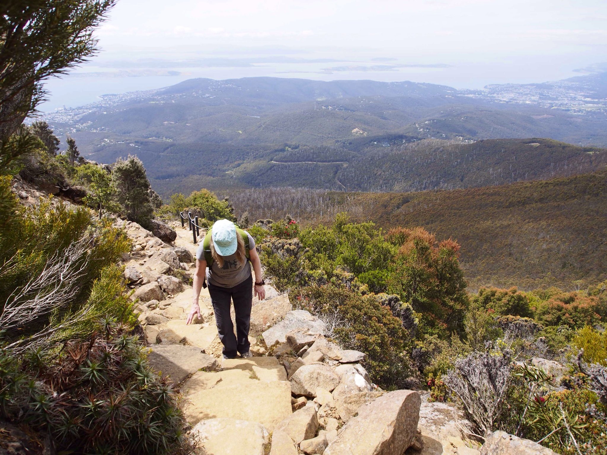
A walker takes it slow and steady, so the climb doesn't seem so steep. Taking frequent breaks provides the opportunity to look over the city below, over the Derwent estuary and out into Storm Bay.
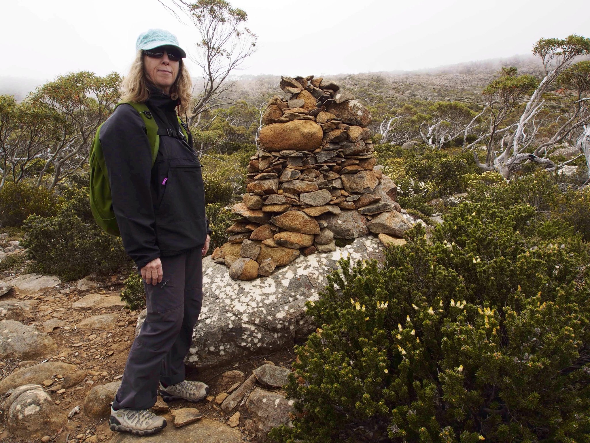
IN THE PHOTO BELOW, Fiona checks out a large cairn, a trail marker, on the Ice House Track.
Allow a minimum of six house if you think about taking the walk from The Springs, up the Zig Zag Track, across the summit plateau and down the Ice House Track. Allow longer if you're less fit. You can do the walk in reverse, too, however my preference is to climb via the Zig Zag as the Ice House Track is rocky. Take water, a snack, something warm to wear if the cold comes in and a waterproof jacket as it can rain, sleet and snow up on the plateau any time of year, summer included.
Most important, though, is to take care and enjoy yourself... and enjoy the superb lump of dolerite that is Mt Wellington... its eucalypt forest and snow gum, its wind-carved boulders and the history of this, Australia's premier urban mountain.
We now turned onto the Ice House Track to make our descent into the forest and return to our starting point, The Springs.
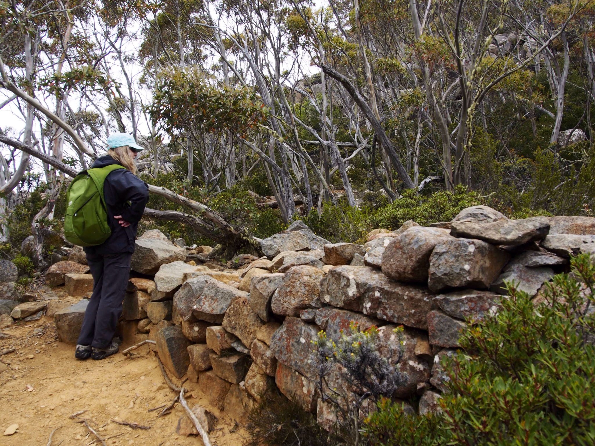
The Ice House Track was the route followed by the ice makers who supplied the frozen water to the city below, in the days before refrigeration. They built a number of structures around here, high on the mountain where water froze. The ice was cut into blocks and taken down to the city.
Those in the photo are the best preserved remains of one of the ice houses, others being mere shapes among the rocks and difficult to locate. Behind the stone wall is a deep depression where, presumably, a small stream was dammed so that it froze.
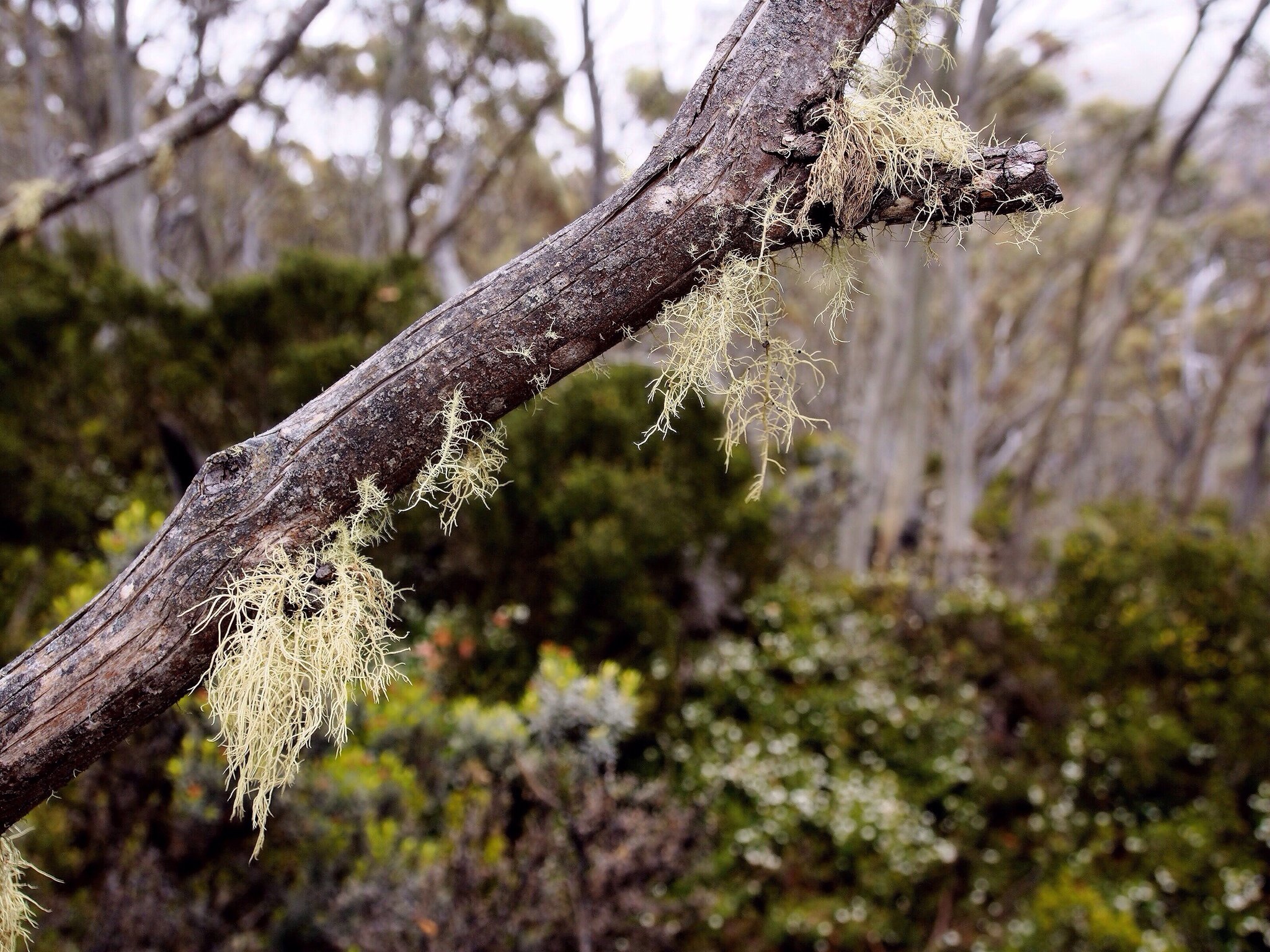
The humid conditions of Mt Wellington creates the conditions for moss to grow on a dead branch in the snow gum forest.
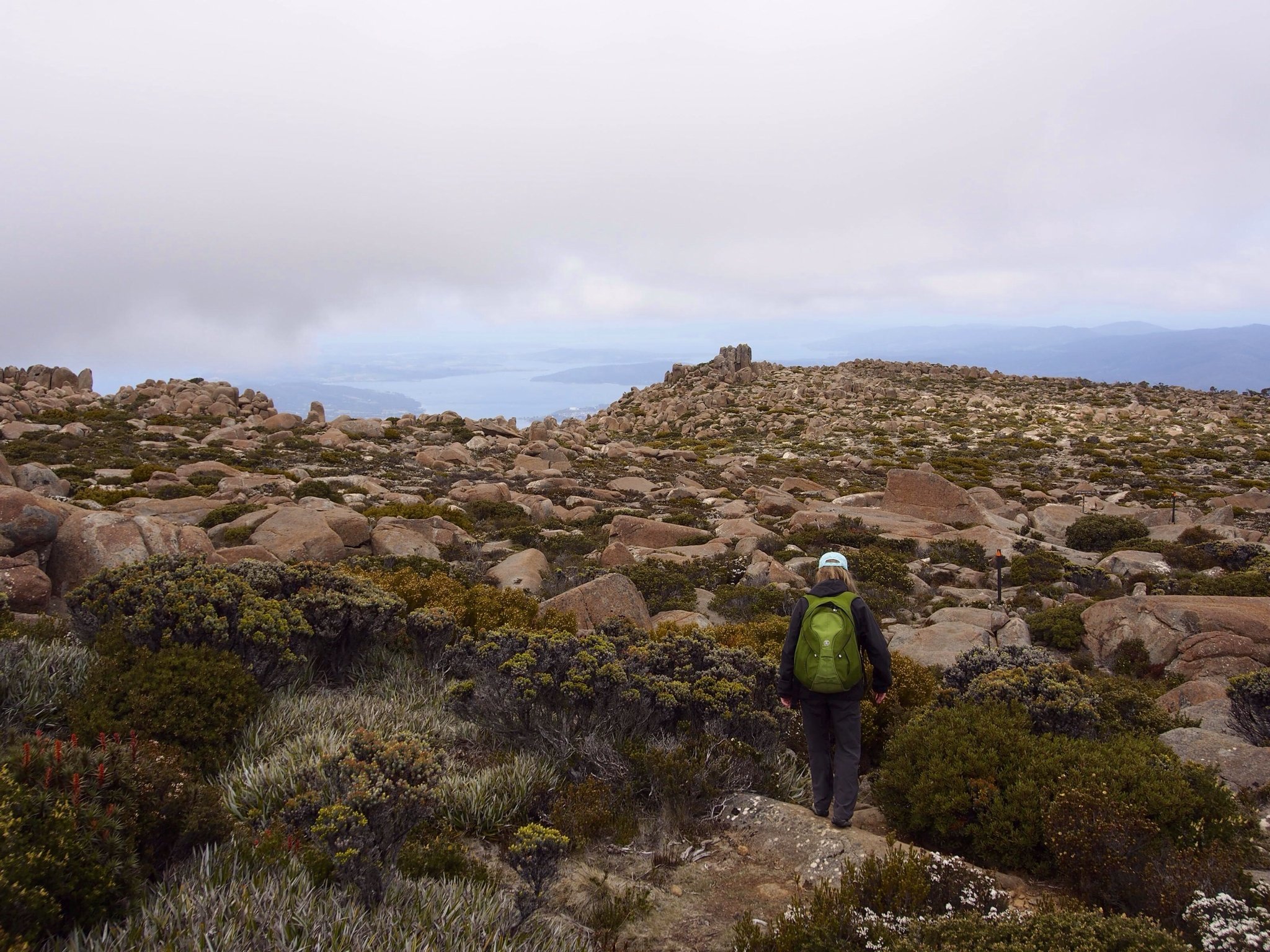
Mt Wellington summit plateau is an undulating boulderfield of igneous dolerite. The summit is periodically buried under snow in winter, so snowpoles mark the track to guide walkers.
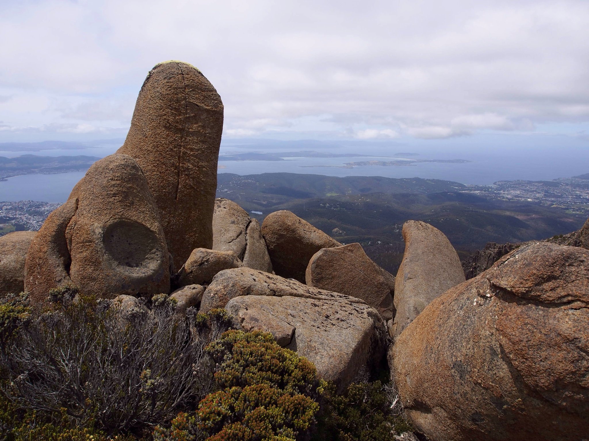
The D'Entrecasteaux Channel, seen in the distance, separates Bruny Island from the Tasmanian mainland. The channel was first seen by Abel Tasman in 1642 and navigated by the french explorer, Bruny D'Entrecasteaux, in 1792.
The D'Entrecasteaux Channel, seen in the distance, separates Bruny Island from the Tasmanian mainland. The channel was first seen by Abel Tasman in 1642 and navigated by the french explorer, Bruny D'Entrecasteaux, in 1792.
Rising above Australia's southernmost city of Hobart, Tasmania, Mt Wellington is a 1250 metre high lump of dolerite that catches the winds, the sleet, the snows coming in from the Southern Ocean.
The Zig Zag Track starts at The Springs, down in the eucalypt forest. It rises steeply as it zig zags through the snow gums, passes into alpine shrubland and, finally, leads you into the boulderfield of the Mt wellington summit plateau.
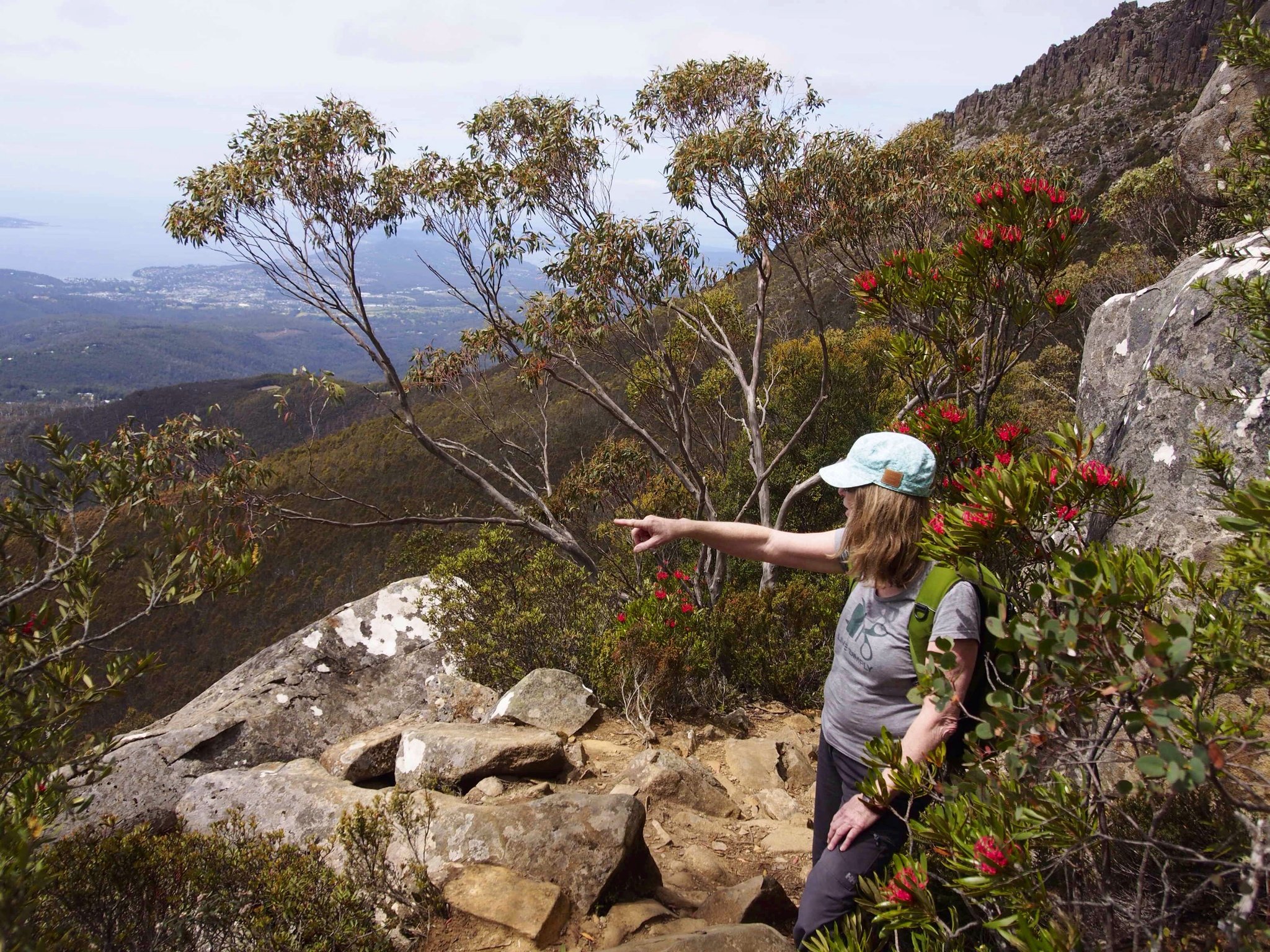
The red flowers seen in the photo are Tasmanian waratah.
The Zig Zag Track starts at The Springs, down in the eucalypt forest. It rises steeply as it zig zags through the snow gums, passes into alpine shrubland and, finally, leads you into the boulderfield of the Mt wellington summit plateau.
The red flowers seen in the photo are Tasmanian waratah.
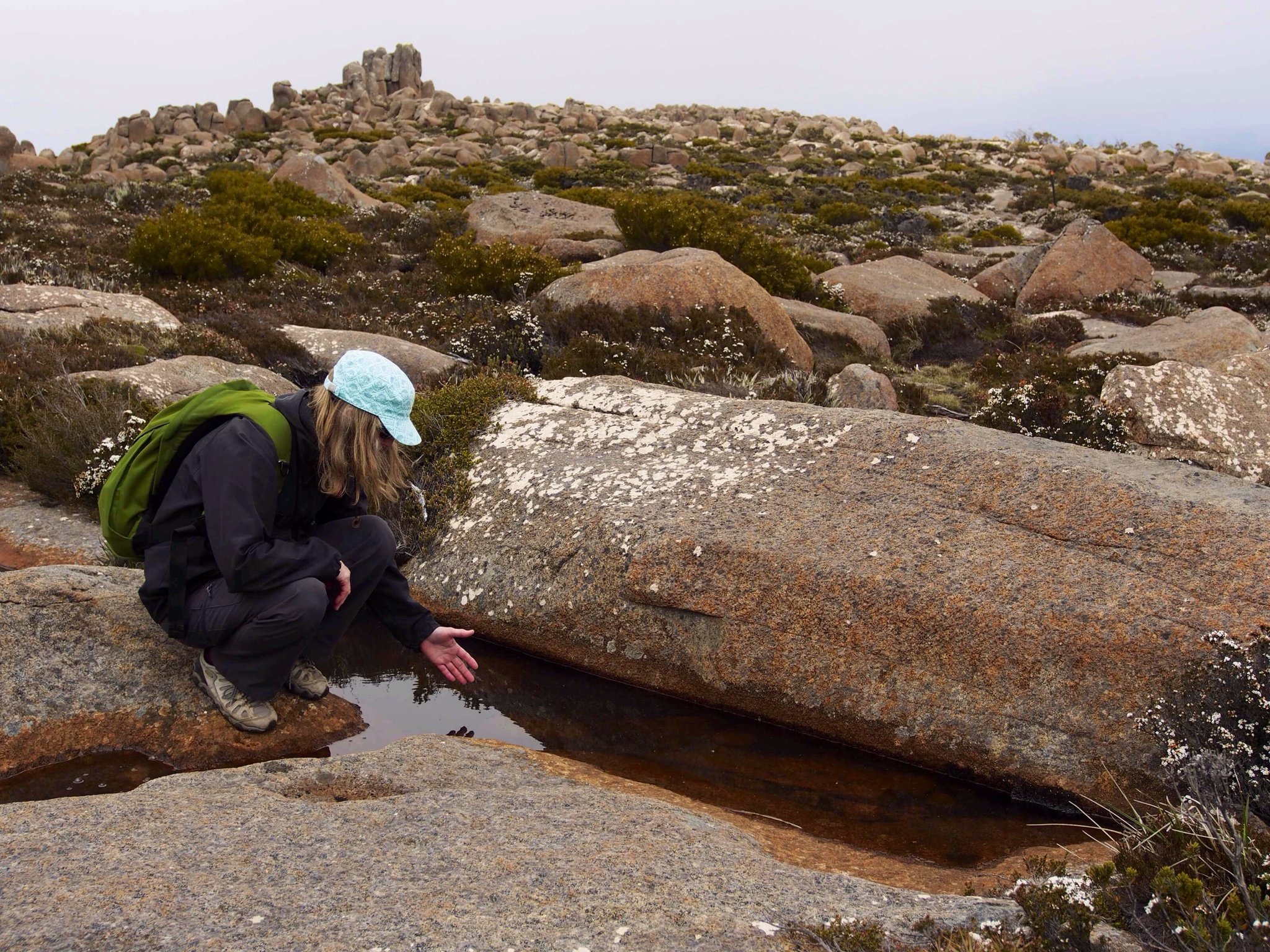
Fiona checks out a small pool of water. There are many tarns like this that dot the plateau, though the warm weather had dried out quite a few of them by the time we walked though.
You can drink the fresh water in the tarns on the summit plateau. Dropped by the rains formed over the Southern Ocean, the water is clean as there is no human habitation here on the summit.
You can drink the fresh water in the tarns on the summit plateau. Dropped by the rains formed over the Southern Ocean, the water is clean as there is no human habitation here on the summit.
It was December, the first month of summer when we walked the Zig Zag Track to the summit, crossed the summit plateau and decended the Ice House Track to return to our starting point at The Springs, lower down the mountain. Coming into the warm season, the alpine flowers were out on the summit pleteau.
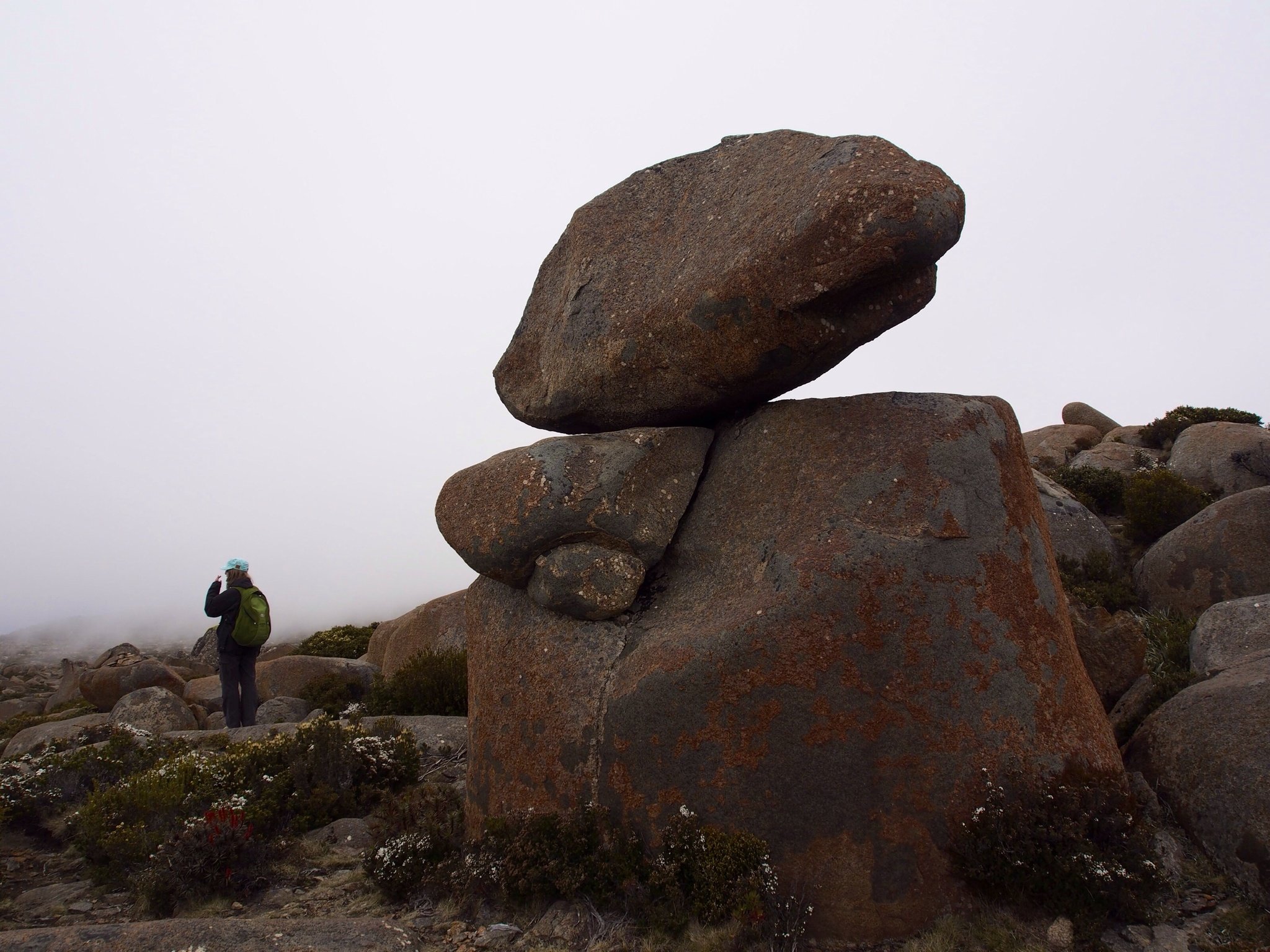
Millennia of wind, rain, snow, summer heat and frost shattering have sculpted the boulders on the summit into interesting shapes.